ZCZC MIATWOEP ALL
TTAA00 KNHC DDHHMM
Tropical Weather Outlook
NWS National Hurricane Center Miami FL
500 PM PDT Fri Aug 9 2019
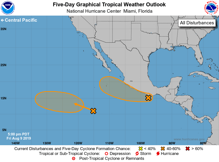
For the eastern North Pacific...east of 140 degrees west longitude:
1. An area of disturbed weather associated with a broad area of low
pressure is hugging the southern coast of Mexico, and some of the
rainbands are already spreading inland over the state of Oaxaca.
This system remains disorganized, but environmental conditions could
favor some gradual development during the next 2 or 3 days while it
moves west-northwestward just off the southwestern coast of Mexico.
After that time conditions are forecast to become unfavorable for
tropical cyclone formation. Regardless of development, the
disturbance will likely bring locally heavy rainfall along portions
of the southern and southwestern coast of Mexico during the next
couple of days.
* Formation chance through 48 hours...low...20 percent.
* Formation chance through 5 days...medium...40 percent.
2. A tropical wave located about 1000 miles south-southwest of the
Baja California peninsula is producing an area of disorganized
showers and thunderstorms. Environmental conditions are expected to
gradually become more conducive for development through the middle
of next week while the system moves westward or west-northwestward
at 10 to 15 mph.
* Formation chance through 48 hours...low...near 0 percent.
* Formation chance through 5 days...medium...40 percent.
Forecaster Avila