ZCZC MIATWOAT ALL
TTAA00 KNHC DDHHMM
Tropical Weather Outlook
NWS National Hurricane Center Miami FL
800 AM EDT Sat Aug 3 2019
For the North Atlantic...Caribbean Sea and the Gulf of Mexico:
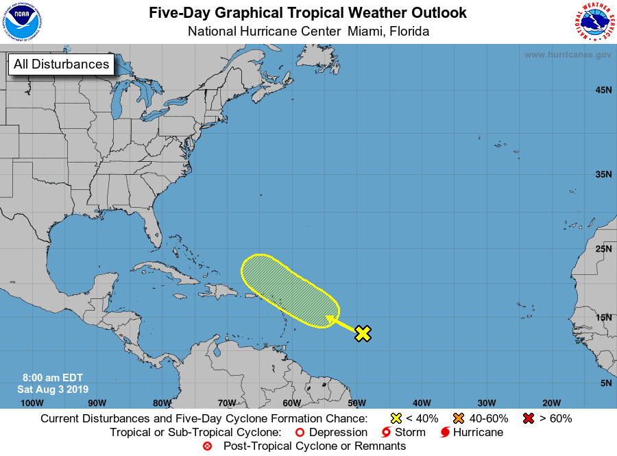
1. An elongated area of low pressure located several hundred miles
east-southeast of the Lesser Antilles is producing a large but
disorganized area of showers and thunderstorms. Only gradual
development of this system is expected for the next few days while
it moves west-northwestward across the northern Lesser Antilles.
Subsequently, some slight additional development is possible by the
middle of next week while the disturbance moves northwestward, north
of Puerto Rico and the Virgin Islands.
* Formation chance through 48 hours...low...20 percent.
* Formation chance through 5 days...low...30 percent.
Forecaster Zelinsky