ZCZC MIATWOEP ALL
TTAA00 KNHC DDHHMM
Tropical Weather Outlook
NWS National Hurricane Center Miami FL
1100 AM PDT Fri Aug 2 2019
For the eastern North Pacific...east of 140 degrees west longitude:
The National Hurricane Center is issuing advisories on Tropical
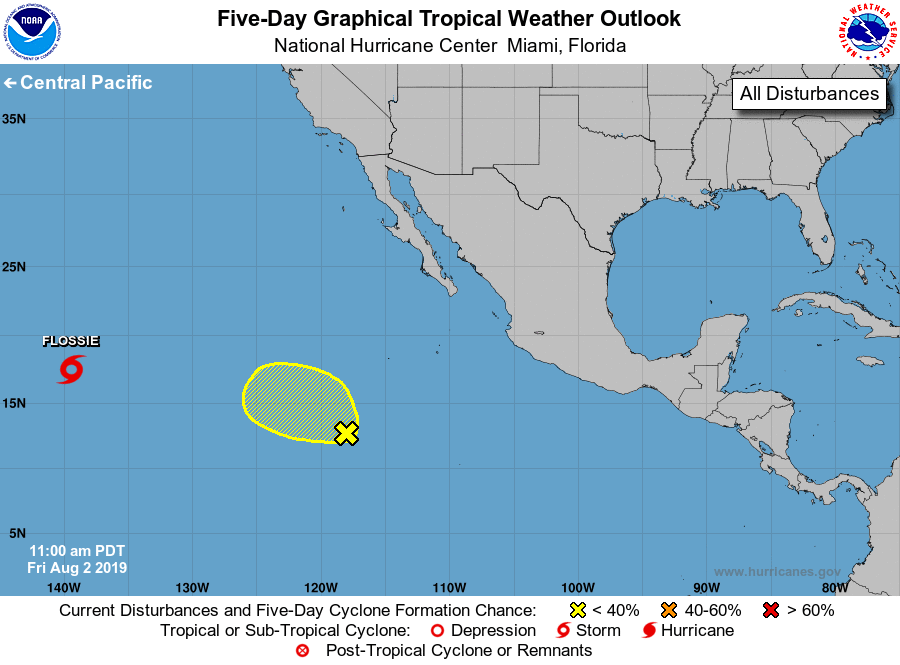
Storm Flossie, located more than a thousand miles east of the
Hawaiian Islands.
1. Showers and thunderstorms associated with a broad area of low
pressure located about 850 miles southwest of the southern tip of
the Baja California peninsula have become a little better organized
since yesterday. Some additional development is possible later
today or tonight while the low moves generally west-northwestward at
about 10 mph. After that, upper-level winds are not expected to be
conducive for development.
* Formation chance through 48 hours...low...30 percent.
* Formation chance through 5 days...low...30 percent.
Forecaster Beven