ZCZC MIATWOEP ALL
TTAA00 KNHC DDHHMM
Tropical Weather Outlook
NWS National Hurricane Center Miami FL
1100 PM PDT Tue Jul 16 2019
For the eastern North Pacific...east of 140 degrees west longitude:
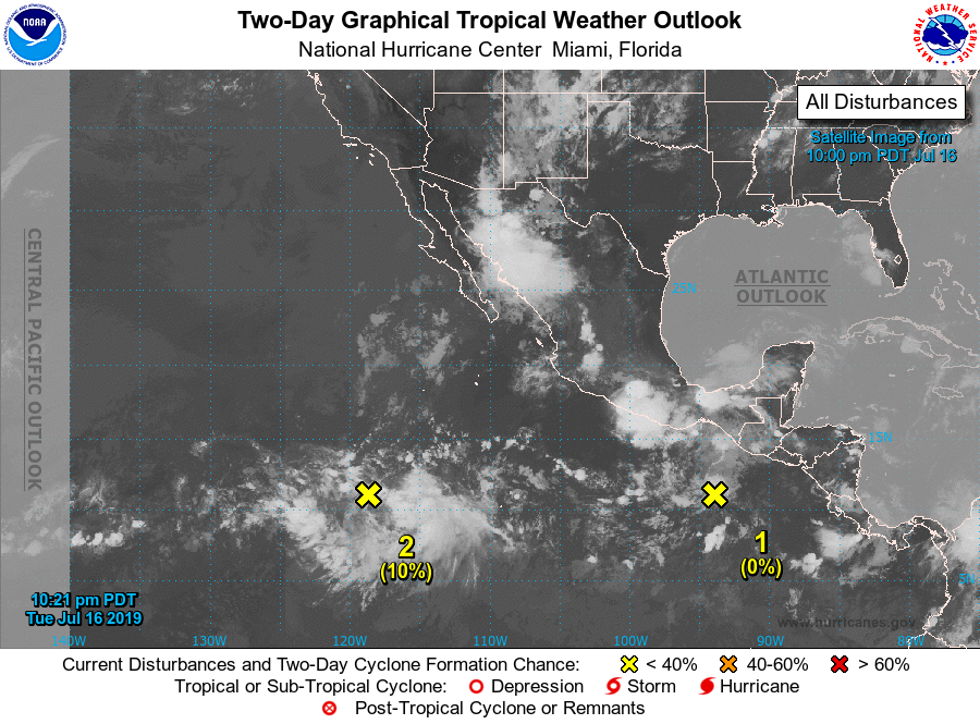
1. A tropical wave located a couple of hundred miles south of the Gulf
of Tehuantepec continues to produce disorganized showers and a few
thunderstorms. Environmental conditions are forecast to become
conducive for gradual development late this week, and a tropical
depression could form over the weekend. This disturbance is
forecast to move westward to west-northwestward at 10 to 15 mph,
well south of the coast of Mexico.
* Formation chance through 48 hours...low...near 0 percent.
* Formation chance through 5 days...medium...50 percent.
2. A large but disorganized area of showers and thunderstorms centered
about 1000 miles south-southwest of the southern tip of the Baja
California peninsula is associated with a tropical wave. Upper-level
winds appear to be somewhat conducive for some slow development
during the next few days while the disturbance moves
west-northwestward at 10 to 15 mph.
* Formation chance through 48 hours...low...10 percent.
* Formation chance through 5 days...low...30 percent.
Forecaster Blake