ZCZC MIATWOEP ALL
TTAA00 KNHC DDHHMM
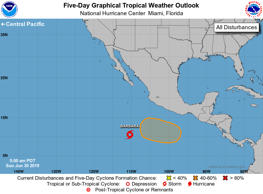
Tropical Weather Outlook
NWS National Hurricane Center Miami FL
500 AM PDT Sun Jun 30 2019
For the eastern North Pacific...east of 140 degrees west longitude:
1. Satellite imagery is indicating that the area of low pressure
located several hundred miles southwest of the southern coast of
Mexico continues to become better organized, and a tropical storm
may be developing. If this trend continues, advisories may be
initiated later this morning on this system as it moves westward to
west-northwestward at about 15 mph. For additional information on
this low see High Seas Forecasts issued by the National Weather
Service.
* Formation chance through 48 hours...high...near 100 percent.
* Formation chance through 5 days...high...near 100 percent.
2. An area of low pressure is expected to form by the middle of next
week several hundred miles south of the southern coast of Mexico.
Conditions appear favorable for gradual development of this system
while it moves westward to west-northwestward.
* Formation chance through 48 hours...low...near 0 percent.
* Formation chance through 5 days...medium...40 percent.
High Seas Forecasts issued by the National Weather Service can be
found under AWIPS header NFDHSFEPI and WMO header FZPN02 KWBC.
Forecaster Latto/Beven