Skip Navigation Links
NOAA NOAA United States Department of Commerce

NHC Graphical Outlook Archive


« Earliest Available         ‹ Earlier         Later ›         Latest Available »
GIS Shapefiles
Central Pacific Eastern Pacific Atlantic

View 2-Day Graphical Tropical Weather Outlook
Click for Atlantic Click for Atlantic

Tropical Weather Outlook Text

ZCZC MIATWOEP ALL
TTAA00 KNHC DDHHMM

Tropical Weather Outlook
NWS National Hurricane Center Miami FL
500 PM PDT Sat Jun 22 2019

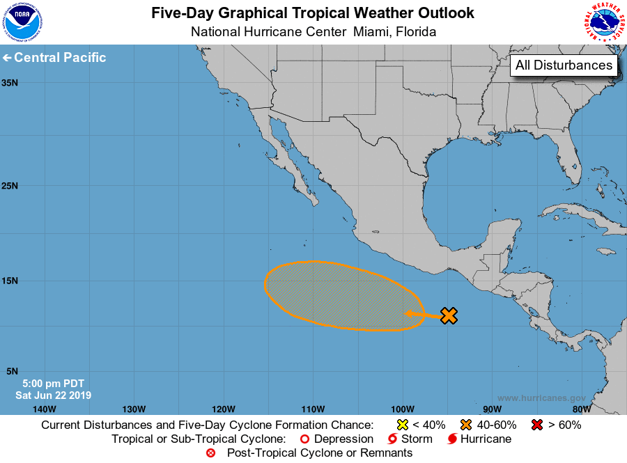
For the eastern North Pacific...east of 140 degrees west longitude:

1. Disorganized showers and thunderstorms located south of the
southeastern coast of Mexico are associated with a tropical wave.
A low pressure area is expected to form in association with this
system in the next day or two.  After that, continued gradual
development is possible, and a tropical depression could form by
the middle of next week while the system moves west-northwestward
away from the coast of Mexico.
* Formation chance through 48 hours...low...20 percent.
* Formation chance through 5 days...medium...60 percent.

Forecaster Beven


List of Atlantic Outlooks (May 2023 - present)
List of East Pacific Outlooks (May 2023 - present)
List of Central Pacific Outlooks (May 2023 - present)
List of Atlantic Outlooks (July 2014 - April 2023)
List of East Pacific Outlooks (July 2014 - April 2023)
List of Central Pacific Outlooks (June 2019 - April 2023)
List of Atlantic Outlooks (June 2009 - June 2014)
List of East Pacific Outlooks (June 2009 - June 2014)