ZCZC MIATWOEP ALL
TTAA00 KNHC DDHHMM
Tropical Weather Outlook
NWS National Hurricane Center Miami FL
500 PM PDT Fri May 24 2019
For the eastern North Pacific...east of 140 degrees west longitude:
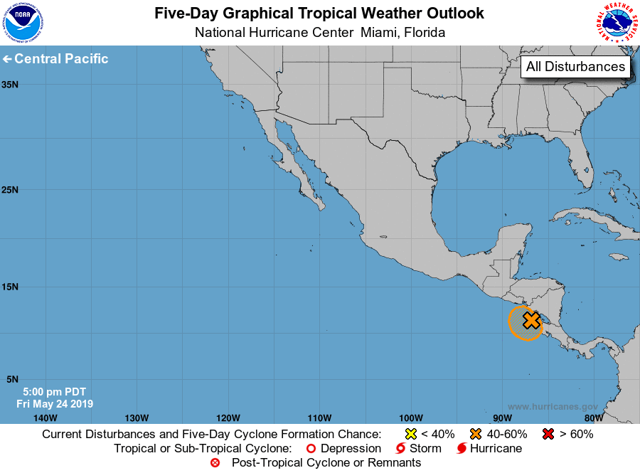
1. A trough of low pressure extending from Nicaragua westward to the
far eastern North Pacific continues to produce disorganized showers
and thunderstorms. This system is expected to meander during the
next few days, and some gradual development is possible if the
disturbance remains offshore. Regardless of development, locally
heavy rains are likely to continue over portions of Central America
through the weekend. These rains could cause flash flooding and
mudslides in areas of mountainous terrain.
* Formation chance through 48 hours...low...30 percent.
* Formation chance through 5 days...medium...40 percent.
Forecaster Cangialosi