Skip Navigation Links
NOAA NOAA United States Department of Commerce

NHC Graphical Outlook Archive


« Earliest Available         ‹ Earlier         Later ›         Latest Available »
GIS Shapefiles
Central Pacific Eastern North Pacific Atlantic

View 2-Day Graphical Tropical Weather Outlook
Click for Eastern North Pacific

Tropical Weather Outlook Text

ZCZC MIATWOAT ALL
TTAA00 KNHC DDHHMM

Special Tropical Weather Outlook
NWS National Hurricane Center Miami FL
550 PM EDT Mon May 20 2019

For the North Atlantic...Caribbean Sea and the Gulf of Mexico:

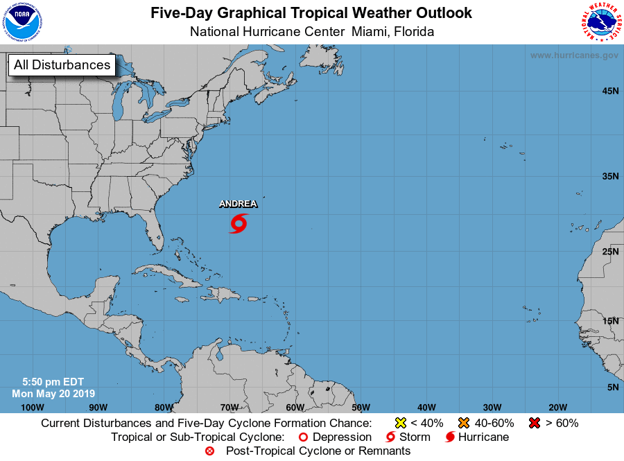
1. Data from an Air Force Reserve reconnaissance aircraft indicate that
the low pressure system located several hundred miles southwest of
Bermuda has developed a well-defined center with maximum sustained
winds of about 40 mph.  A special advisory will be issued on
Subtropical Storm Andrea by 6:30 PM EDT or 2230 UTC.
* Formation chance through 48 hours...high...near 100 percent.
* Formation chance through 5 days...high...near 100 percent.

Forecaster Zelinsky/Cangialosi


List of Atlantic Outlooks (May 2023 - present)
List of East Pacific Outlooks (May 2023 - present)
List of Central Pacific Outlooks (May 2023 - present)
List of Atlantic Outlooks (July 2014 - April 2023)
List of East Pacific Outlooks (July 2014 - April 2023)
List of Central Pacific Outlooks (June 2019 - April 2023)
List of Atlantic Outlooks (June 2009 - June 2014)
List of East Pacific Outlooks (June 2009 - June 2014)