ZCZC MIATWOAT ALL
TTAA00 KNHC DDHHMM
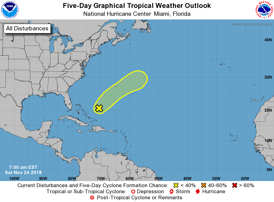
Tropical Weather Outlook
NWS National Hurricane Center Miami FL
700 AM EST Sat Nov 24 2018
For the North Atlantic...Caribbean Sea and the Gulf of Mexico:
1. A low pressure system located over the southwestern Atlantic is
forecast to become a powerful non-tropical cyclone on Sunday.
Conditions are expected to be only marginally conducive for the low
to acquire subtropical characteristics during the next day or two
while it moves quickly east-northeastward across the western and
central Atlantic. Regardless of subtropical development, winds to
gale force are expected over portions of the western Atlantic this
weekend, and will likely reach the central Atlantic by late Sunday
or early Monday. Additional information on this system can be found
in High Seas Forecasts issued by the National Weather Service.
* Formation chance through 48 hours...low...10 percent.
* Formation chance through 5 days...low...10 percent.
High Seas Forecasts issued by the National Weather Service are
issued under AWIPS header NFDHSFAT1, WMO header FZNT01 KWBC, and
are available on the Web at
https://ocean.weather.gov/shtml/NFDHSFAT1.shtml.
Forecaster Zelinsky