ZCZC MIATWOAT ALL
TTAA00 KNHC DDHHMM
Tropical Weather Outlook
NWS National Hurricane Center Miami FL
700 PM EST Sun Nov 11 2018
For the North Atlantic...Caribbean Sea and the Gulf of Mexico:
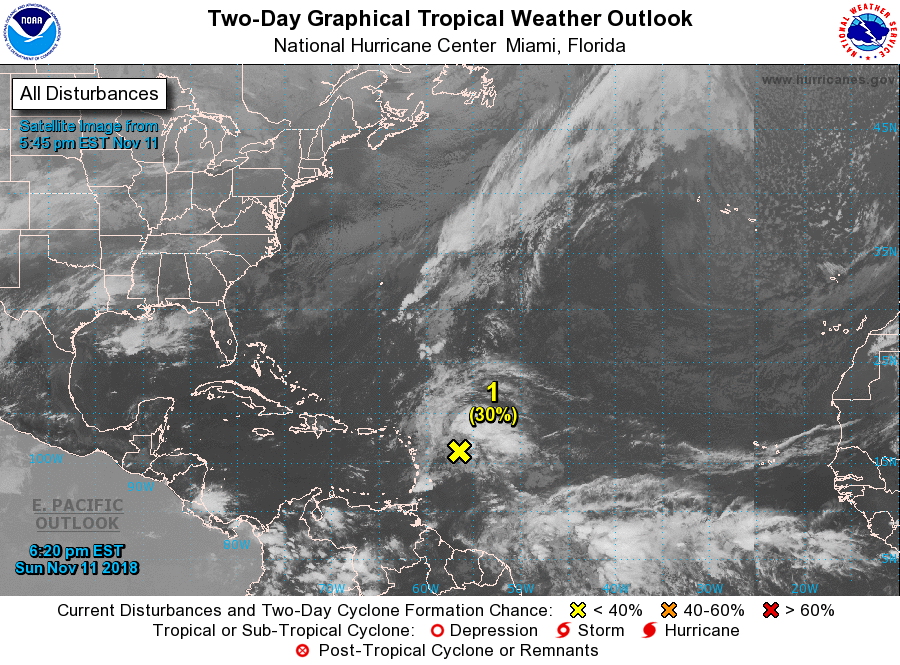
1. A large area of cloudiness and thunderstorms extending from near
the Lesser Antilles northeastward over the tropical Atlantic for
several hundred miles is associated with a westward-moving tropical
wave and an upper-level trough of low pressure. Showers and
thunderstorms associated with this disturbance have increased today,
and environmental conditions are expected to gradually become more
conducive for the development of a tropical or subtropical cyclone
by the middle of the week. The system is forecast to move westward
to west-northwestward for the next few days, passing near or north
of the Leeward Islands, Puerto Rico, Hispaniola, and the
southeastern Bahamas.
* Formation chance through 48 hours...low...30 percent.
* Formation chance through 5 days...high...70 percent.
Forecaster Brown