ZCZC MIATWOAT ALL
TTAA00 KNHC DDHHMM
Tropical Weather Outlook
NWS National Hurricane Center Miami FL
700 PM EST Sat Nov 10 2018
For the North Atlantic...Caribbean Sea and the Gulf of Mexico:
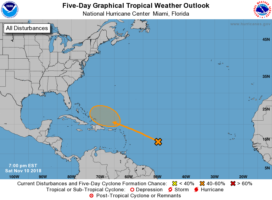
1. A tropical wave located several hundred miles east of the Lesser
Antilles is producing a large but disorganized area of cloudiness
and thunderstorms. Significant development of this system is not
expected during the next couple of days due to strong upper-level
winds. However, conditions are forecast to become a little more
conducive by Tuesday, and a tropical or subtropical cyclone could
form during the middle of next week while the system moves near or
north of Puerto Rico, Hispaniola and the southeastern Bahamas.
* Formation chance through 48 hours...low...near 0 percent.
* Formation chance through 5 days...medium...40 percent.
Forecaster Avila