ZCZC MIATWOAT ALL
TTAA00 KNHC DDHHMM
Tropical Weather Outlook
NWS National Hurricane Center Miami FL
800 AM EDT Wed Oct 24 2018
For the North Atlantic...Caribbean Sea and the Gulf of Mexico:
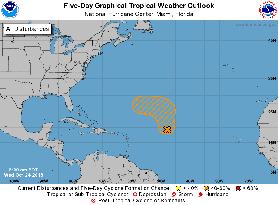
1. A large area of disorganized showers and thunderstorms over the
central tropical Atlantic Ocean is associated with a broad area
of low pressure located a little over 900 miles east of the
northern Leeward Islands. This system is expected to move slowly
northward over the next few days into an area where environmental
conditions are forecast to be more conducive for development. A
tropical or subtropical depression could form over the weekend while
the system turns westward well to the northeast of the Lesser
Antilles.
* Formation chance through 48 hours...low...30 percent.
* Formation chance through 5 days...medium...60 percent.
Forecaster Roberts