ZCZC MIATWOEP ALL
TTAA00 KNHC DDHHMM
Tropical Weather Outlook
NWS National Hurricane Center Miami FL
1100 AM PDT Fri Oct 19 2018
For the eastern North Pacific...east of 140 degrees west longitude:
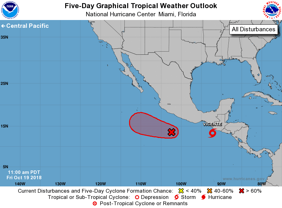
The National Hurricane Center has initiated advisories on Tropical
Depression Twenty-Three-E, located just offshore of the Pacific
coast of Guatemala.
1. Showers and thunderstorms associated with an area of low pressure
centered a few hundred miles south-southwest of Zihuatanejo, Mexico,
are gradually becoming better organized. Environmental conditions
are expected to become increasingly favorable for further
development, and a tropical depression is expected to form later
today or tomorrow while the low moves west-northwestward at about 10
mph, well offshore of the coast of southwestern Mexico.
* Formation chance through 48 hours...high...80 percent.
* Formation chance through 5 days...high...90 percent.
Public Advisories on Tropical Depression Twenty-Three-E are issued
under WMO header WTPZ33 KNHC and under AWIPS header MIATCPEP3.
Forecast/Advisories on Tropical Depression Twenty-Three-E are issued
under WMO header WTPZ23 KNHC and under AWIPS header MIATCMEP3.
Forecaster Berg