ZCZC MIATWOEP ALL
TTAA00 KNHC DDHHMM
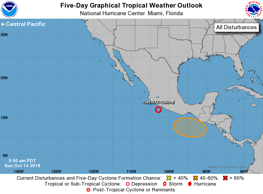
Tropical Weather Outlook
NWS National Hurricane Center Miami FL
500 AM PDT Sun Oct 14 2018
For the eastern North Pacific...east of 140 degrees west longitude:
1. A small low pressure system is located about 200 miles south-
southeast of Manzanillo, Mexico. Associated shower and thunderstorm
activity has changed little in organization overnight due to
moderate winds aloft. However, upper-level winds are expected to
gradually become more conducive for development of this disturbance
during the next couple of days, and a tropical depression is likely
to form by early this week while the low moves slowly westward to
west-northwestward just offshore the coast of southwestern Mexico.
Regardless of development, heavy rains are possible along coastal
sections of the Mexican states of Guerrero, Michoacan, and Colima
during the next few days, and interests in those areas should
monitor the progress of this system and refer to products issued by
the Mexican Meteorological Service.
* Formation chance through 48 hours...high...70 percent.
* Formation chance through 5 days...high...80 percent.
2. A low pressure area is forecast to develop a few hundred miles south
of the southeastern coast of Mexico around the middle of next week.
Environmental conditions are expected to be somewhat favorable for
development of the system while it moves generally westward,
parallel to the coast of Mexico.
* Formation chance through 48 hours...low...near 0 percent.
* Formation chance through 5 days...medium...40 percent.
Forecaster Stewart