ZCZC MIATWOAT ALL
TTAA00 KNHC DDHHMM
Tropical Weather Outlook
NWS National Hurricane Center Miami FL
200 AM EDT Tue Oct 2 2018
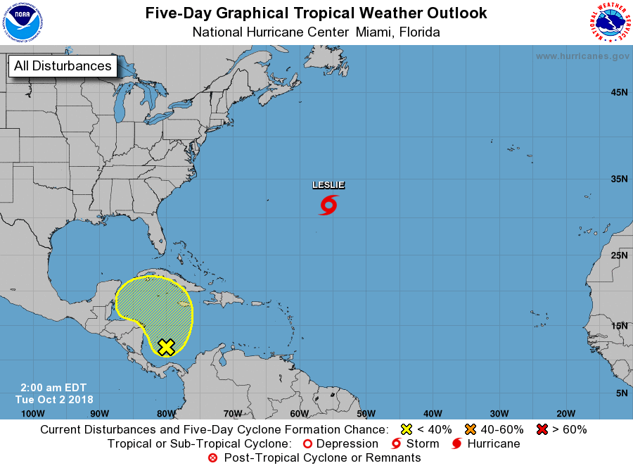
For the North Atlantic...Caribbean Sea and the Gulf of Mexico:
The National Hurricane Center is issuing advisories on Tropical
Storm Leslie, located over the central Atlantic Ocean.
1. Surface observations and satellite-derived wind data indicate that
a broad area of low pressure has developed over the southwestern
Caribbean Sea a couple hundred miles north of Panama. Shower and
thunderstorm activity is currently limited, and unfavorable
upper-level winds are expected to inhibit development over the next
couple of days while the low drifts generally northward. By late
week and over the weekend, however, upper-level winds are forecast
to become a little more conducive for development when the system
will be moving northwestward into the northwestern Caribbean Sea.
* Formation chance through 48 hours...low...near 0 percent.
* Formation chance through 5 days...low...20 percent.
Forecaster Stewart