ZCZC MIATWOEP ALL
TTAA00 KNHC DDHHMM
Tropical Weather Outlook
NWS National Hurricane Center Miami FL
500 PM PDT Fri Sep 28 2018
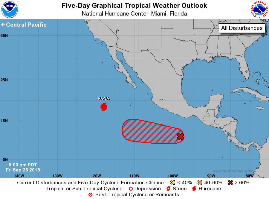
For the eastern North Pacific...east of 140 degrees west longitude:
The National Hurricane Center is issuing advisories on Hurricane
Rosa, located several hundred miles southwest of the southern tip of
the Baja California peninsula.
1. Satellite and NOAA Hurricane Hunter data indicate that an area
of low pressure centered a few hundred miles south of Acapulco,
Mexico, is producing tropical-storm-force winds. However, the data
also show that the system does not have a well-defined center.
Environmental conditions are very conducive for further development,
and the low is expected to become a tropical storm on Saturday while
it moves west-northwestward well offshore of the coast of Mexico.
* Formation chance through 48 hours...high...near 100 percent.
* Formation chance through 5 days...high...near 100 percent.
For additional information on the low please see High Seas Forecasts
issued by the National Weather Service, under AWIPS header
NFDHSFEPI, WMO header FZPN02 KWBC, and on the web at
https://ocean.weather.gov/shtml/NFDHSFEPI.shtml
Forecaster Blake