ZCZC MIATWOEP ALL
TTAA00 KNHC DDHHMM
Tropical Weather Outlook
NWS National Hurricane Center Miami FL
500 PM PDT Wed Sep 5 2018
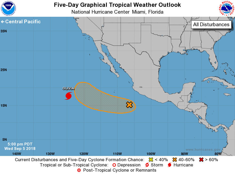
For the eastern North Pacific...east of 140 degrees west longitude:
The National Hurricane Center is issuing advisories on Hurricane
Olivia, located about 1000 miles west-southwest of the southern
tip of the Baja California peninsula.
1. A broad area of low pressure is centered about 350 miles south-
southwest of Manzanillo, Mexico. The shower activity associated
with this low has increased a little during the past several hours
and the upper-level winds are gradually becoming more conducive for
development. A tropical depression could form by late this
weekend or early next week while the system moves slowly toward
the west-northwest at about 10 mph away from the coast of Mexico.
* Formation chance through 48 hours...low...30 percent.
* Formation chance through 5 days...medium...60 percent.
Forecaster Avila