ZCZC MIATWOAT ALL
TTAA00 KNHC DDHHMM
Tropical Weather Outlook
NWS National Hurricane Center Miami FL
200 PM EDT Sat Sep 1 2018
For the North Atlantic...Caribbean Sea and the Gulf of Mexico:
The National Hurricane Center is issuing advisories on Tropical
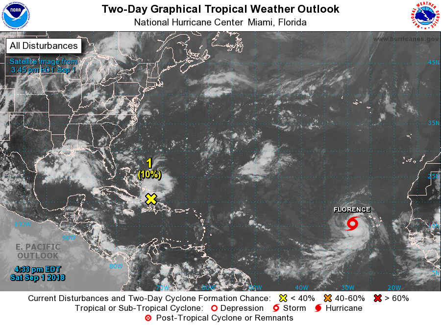
Storm Florence, located about a couple of hundred miles west of the
Cabo Verde Islands.
1. Cloudiness and showers over the Turks and Caicos Islands and the
southeastern Bahamas have increased a little bit today. This
activity is associated with a tropical wave interacting with an
upper-level trough. This weather system is expected to spread
westward across the remainder of the Bahamas this weekend, and move
across southern Florida and into the eastern Gulf of Mexico by early
next week. Surface pressures are not falling at this time, and
development is not anticipated during the next day or two.
Environmental conditions, however, are forecast to become a little
more favorable for a surface low pressure area to form when the
disturbance moves across the Gulf of Mexico during the early to
middle part of next week.
* Formation chance through 48 hours...low...10 percent.
* Formation chance through 5 days...medium...40 percent.
Forecaster Avila