ZCZC MIATWOAT ALL
TTAA00 KNHC DDHHMM
Tropical Weather Outlook
NWS National Hurricane Center Miami FL
200 PM EDT Wed Aug 29 2018
For the North Atlantic...Caribbean Sea and the Gulf of Mexico:
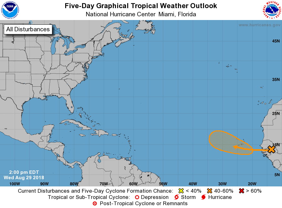
1. A vigorous low pressure area associated with a tropical wave is
forecast to form between the coast of Africa and the Cabo Verde
Islands on Thursday. Conditions appears to be favorable for
development, and a tropical depression could form over the weekend
while the system moves west-northwestward near the Cabo Verde
Islands and the adjacent Atlantic. This system is expected to bring
rains and gusty winds to those islands in two or three days, and
interests in that region should monitor the progress of this
disturbance.
* Formation chance through 48 hours...low...30 percent.
* Formation chance through 5 days...medium...60 percent.
Forecaster Avila