ZCZC MIATWOEP ALL
TTAA00 KNHC DDHHMM
Tropical Weather Outlook
NWS National Hurricane Center Miami FL
1100 AM PDT Mon Aug 13 2018
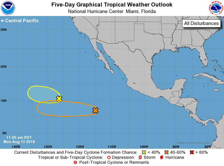
For the eastern North Pacific...east of 140 degrees west longitude:
1. Showers and thunderstorms have become more concentrated in
association with a low pressure area located about 850 miles
south-southwest of the southern tip of the Baja California
peninsula. Environmental conditions are conducive for slow
development, and a tropical depression could form late this week
while the disturbance moves westward at 10 to 15 mph.
* Formation chance through 48 hours...low...20 percent.
* Formation chance through 5 days...medium...50 percent.
2. A broad low pressure area located a little over 1200 miles
west-southwest of the southern tip of the Baja California peninsula
is producing showers and thunderstorms. While this system is
showing some signs of organization, the low is forecast to reach
cooler waters by tomorrow afternoon, which would limit further
development chances.
* Formation chance through 48 hours...low...30 percent.
* Formation chance through 5 days...low...30 percent.
Forecaster Blake