ZCZC MIATWOAT ALL
TTAA00 KNHC DDHHMM
Tropical Weather Outlook
NWS National Hurricane Center Miami FL
800 PM EDT Mon Aug 6 2018
For the North Atlantic...Caribbean Sea and the Gulf of Mexico:
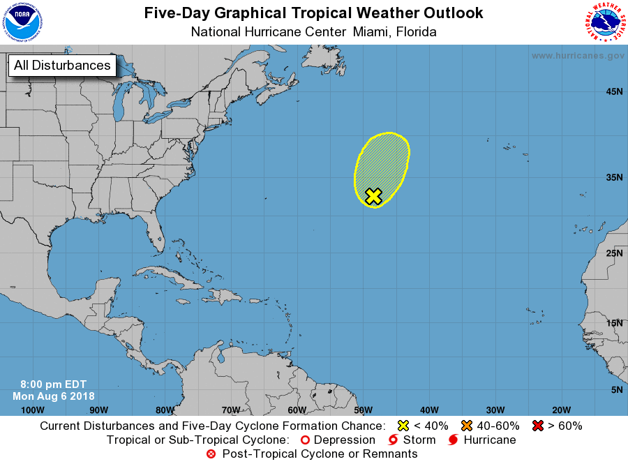
1. A non-tropical low pressure system centered a little more than 1000
miles west-southwest of the Azores is interacting with an upper-
level low, and most of its associated shower activity remains
disorganized. Environmental conditions could favor some development
during the next day or so, but after that time, the low will
encounter increasing cooler waters and development is not
anticipated. The low is already moving toward the north-northeast,
and this motion should continue for the next several days over the
open North Atlantic. Additional information on this system can be
found in High Seas Forecasts issued by the National Weather Service.
* Formation chance through 48 hours...low...30 percent.
* Formation chance through 5 days...low...30 percent.
High Seas Forecasts issued by the National Weather Service can be
found under AWIPS header NFDHSFAT1, WMO header FZNT01 KWBC, and
on the Web at https://ocean.weather.gov/shtml/NFDHSFAT1.shtml.
Forecaster Avila