ZCZC MIATWOEP ALL
TTAA00 KNHC DDHHMM
Tropical Weather Outlook
NWS National Hurricane Center Miami FL
500 AM PDT Sat Jul 21 2018
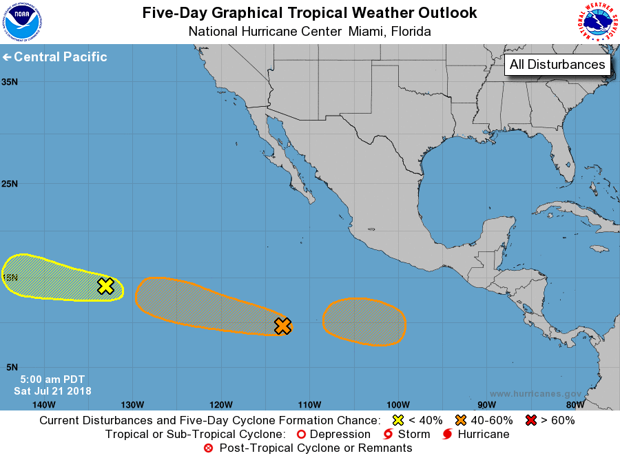
For the eastern North Pacific...east of 140 degrees west longitude:
1. Disorganized showers and thunderstorms associated with a broad area
of low pressure are located a little more than 1700 miles west-
southwest of the southern tip of the Baja California peninsula. The
system is already embedded within unfavorable upper-level winds and
development is unlikely. The low is expected to move westward
at 15 to 20 mph and cross into the Central Pacific basin on
late Sunday or early Monday.
* Formation chance through 48 hours...low...10 percent.
* Formation chance through 5 days...low...10 percent.
2. Another area of disturbed weather is located several hundred miles
south of the southwest coast of Mexico. Although this system is not
showing any signs of organization at this time, conditions are
forecast to become favorable for development and a tropical
depression could form early next week. This disturbance is expected
to move toward the west-northwest at 15 to 20 mph during the next
several days.
* Formation chance through 48 hours...low...10 percent.
* Formation chance through 5 days...medium...60 percent.
3. And yet another area of low pressure is likely to form early next
week several hundred miles south of the southern coast of Mexico.
Environmental conditions appear to be conducive for gradual
development of this system while it moves toward the west or
west-northwest well south of Mexico.
* Formation chance through 48 hours...low...near 0 percent.
* Formation chance through 5 days...medium...40 percent.
Forecaster Avila