ZCZC MIATWOEP ALL
TTAA00 KNHC DDHHMM
Tropical Weather Outlook
NWS National Hurricane Center Miami FL
1100 AM PDT Sun Jul 15 2018
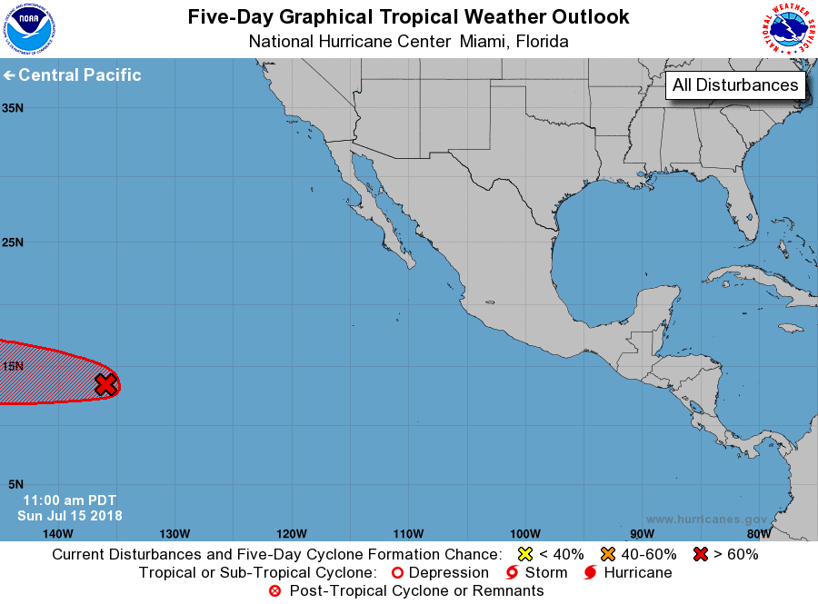
For the eastern North Pacific...east of 140 degrees west longitude:
1. Satellite images indicate that the circulation of low pressure
system located about 1300 miles east-southeast of the Big Island of
Hawaii has become a little better defined today. However, the
associated shower and thunderstorm activity is still not
particularly well organized. Environmental conditions appear
conducive for gradual development, and a tropical depression could
form during the next couple of days before upper-level winds
increase. This system is expected to move westward and it should
cross into the Central Pacific basin on Monday.
* Formation chance through 48 hours...medium...60 percent.
* Formation chance through 5 days...high...70 percent.
Forecaster Cangialosi