ZCZC MIATWOAT ALL
TTAA00 KNHC DDHHMM
Tropical Weather Outlook
NWS National Hurricane Center Miami FL
200 PM EDT Mon Jun 18 2018
For the North Atlantic...Caribbean Sea and the Gulf of Mexico:
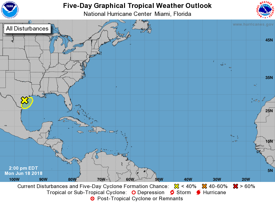
1. Surface observations and WSR-88D Doppler Radar data indicate that a
surface trough associated with an upper-level low pressure system
has moved onto the coast of Texas. This system continues to produce
disorganized showers and thunderstorms and strong gusty winds over
the northwestern Gulf of Mexico. Heavy rainfall and flash flooding
across portions of southern and southeastern Texas are likely to
continue during the next few days. For more details on this
disturbance and the threat for heavy rainfall, please see products
issued by your local weather office and High Seas Forecasts issued
by the National Weather Service.
* Formation chance through 48 hours...low...10 percent.
* Formation chance through 5 days...low...10 percent.
High Seas Forecasts issued by the National Weather Service can be
found under AWIPS header NFDHSFAT1, WMO header FZNT01 KWBC, and
on the Web at https://ocean.weather.gov/shtml/NFDHSFAT1.shtml.
Forecaster Roberts