ZCZC MIATWOAT ALL
TTAA00 KNHC DDHHMM
Tropical Weather Outlook
NWS National Hurricane Center Miami FL
800 PM EDT Sun Jun 17 2018
For the North Atlantic...Caribbean Sea and the Gulf of Mexico:
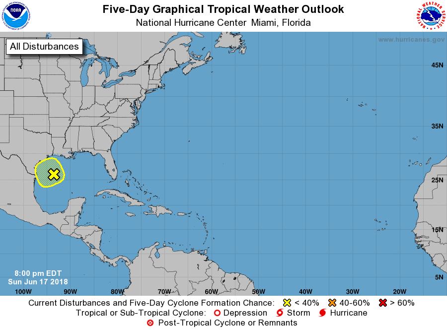
1. A surface trough is producing a large but disorganized area of
showers and thunderstorms over the west-central and northwestern
Gulf of Mexico. Strong gusty winds to near 40 mph are accompanying
some of the stronger thunderstorms. Environmental conditions do
not support significant development. However, heavy rains and gusty
winds are likely to continue across the northwestern Gulf of Mexico
through tonight. This activity will reach portions of the Texas and
southwestern Louisiana coasts later tonight and on Monday. For more
details on this disturbance, please see products issued by your
local weather office and High Seas Forecasts issued by the National
Weather Service.
* Formation chance through 48 hours...low...20 percent.
* Formation chance through 5 days...low...20 percent.
High Seas Forecasts issued by the National Weather Service can be
found under AWIPS header NFDHSFAT1, WMO header FZNT01 KWBC, and
on the Web at https://ocean.weather.gov/shtml/NFDHSFAT1.shtml.
Forecaster Stewart