ZCZC MIATWOAT ALL
TTAA00 KNHC DDHHMM
Tropical Weather Outlook
NWS National Hurricane Center Miami FL
700 AM EST Tue Nov 14 2017
For the North Atlantic...Caribbean Sea and the Gulf of Mexico:
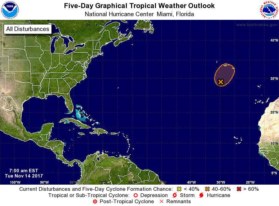
1. Showers and thunderstorms have changed little in organization during
the past several hours in association with an area of low pressure
located about 300 miles south-southwest of the Azores. This system
still has the potential to become a subtropical cyclone during the
next couple of days before upper-level winds become unfavorable.
Regardless of development, this low is expected to produce winds to
near gale force during the next day or two while it moves slowly
northeastward. For additional information on this system, see High
Seas Forecasts issued by Meteo France.
* Formation chance through 48 hours...medium...50 percent.
* Formation chance through 5 days...medium...50 percent.
High Seas Forecasts issued by Meteo France can be found under WMO
header FQNT50 LFPW and on the web at
http://www.meteofrance.com/previsions-meteo-marine/bulletin.
Forecaster Brennan