ZCZC MIATWOEP ALL
TTAA00 KNHC DDHHMM
Tropical Weather Outlook
NWS National Hurricane Center Miami FL
400 PM PST Sun Nov 12 2017
For the eastern North Pacific...east of 140 degrees west longitude:
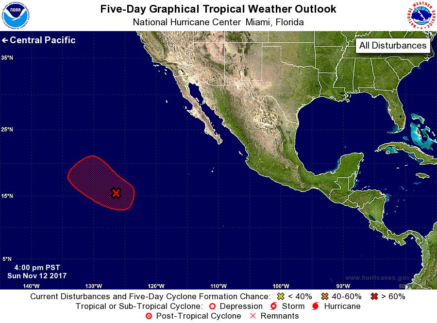
1. Satellite imagery indicates that the low pressure area located about
1200 miles southwest of the southern tip of the Baja California
peninsula is producing widespread cloudiness and showers. Only a
slight increase in organization would result in the formation of a
tropical depression later today or tonight. By Tuesday, however,
upper-level winds are expected become quite unfavorable for tropical
cyclone formation to occur. This system is forecast to move
northwestward at 15 to 20 mph across the open eastern Pacific during
the next few days.
* Formation chance through 48 hours...high...70 percent.
* Formation chance through 5 days...high...70 percent.
Forecaster Stewart