ZCZC MIATWOAT ALL
TTAA00 KNHC DDHHMM
Tropical Weather Outlook
NWS National Hurricane Center Miami FL
100 PM EST Sun Nov 5 2017
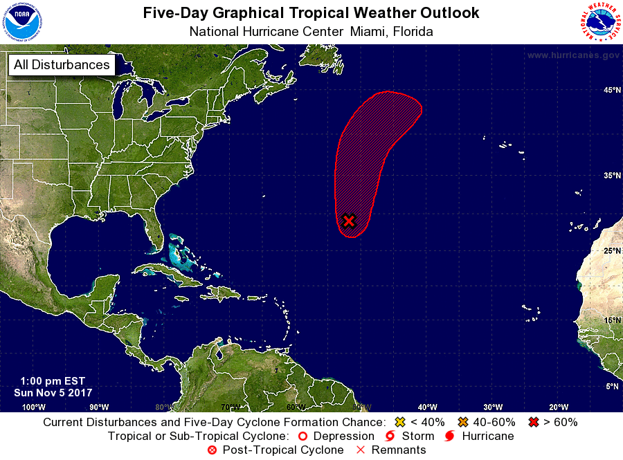
For the North Atlantic...Caribbean Sea and the Gulf of Mexico:
1. A well-defined low pressure system is located about 800 miles
east-southeast of Bermuda. Associated shower and thunderstorm
activity is beginning to show signs of organization, and
environmental conditions are expected to be marginally conducive
for the development of a tropical or subtropical cyclone during the
next few days while the low moves northward to north-northeastward.
Conditions are forecast to become unfavorable for development by
Thursday when the low will be moving over the cold waters of the
far north Atlantic.
* Formation chance through 48 hours...medium...50 percent.
* Formation chance through 5 days...high...70 percent.
Forecaster Stewart