Skip Navigation Links
NOAA NOAA United States Department of Commerce

NHC Graphical Outlook Archive


« Earliest Available         ‹ Earlier         Later ›         Latest Available »
GIS Shapefiles
tab Eastern North Pacific tab tab Atlantic tab

View 2-Day Graphical Tropical Weather Outlook
Click for Eastern North Pacific

Tropical Weather Outlook Text

ZCZC MIATWOAT ALL
TTAA00 KNHC DDHHMM

Tropical Weather Outlook
NWS National Hurricane Center Miami FL
800 PM EDT Fri Oct 27 2017

For the North Atlantic...Caribbean Sea and the Gulf of Mexico:

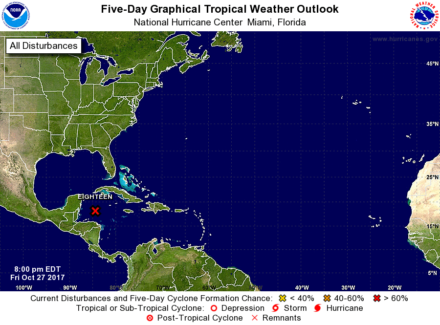
The National Hurricane Center is issuing advisories on Potential
Tropical Cyclone Eighteen, located over the northwestern Caribbean
Sea.
* Formation chance through 48 hours...high...80 percent.
* Formation chance through 5 days...high...80 percent.

&&
Public Advisories on Potential Tropical Cyclone Eighteen are issued
under WMO header WTNT33 KNHC and under AWIPS header MIATCPAT3.
Forecast/Advisories on Potential Tropical Cyclone Eighteen are
issued under WMO header WTNT23 KNHC and under AWIPS header
MIATCMAT3.

$$
Forecaster Beven
NNNN


List of Atlantic Outlooks (May 2023 - present)
List of East Pacific Outlooks (May 2023 - present)
List of Central Pacific Outlooks (May 2023 - present)
List of Atlantic Outlooks (July 2014 - April 2023)
List of East Pacific Outlooks (July 2014 - April 2023)
List of Central Pacific Outlooks (June 2019 - April 2023)
List of Atlantic Outlooks (June 2009 - June 2014)
List of East Pacific Outlooks (June 2009 - June 2014)