ZCZC MIATWOAT ALL
TTAA00 KNHC DDHHMM
Tropical Weather Outlook
NWS National Hurricane Center Miami FL
800 PM EDT Mon Oct 23 2017
For the North Atlantic...Caribbean Sea and the Gulf of Mexico:
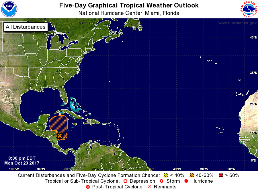
1. An elongated area of low pressure has formed near the northeastern
coast of Nicaragua. This broad disturbance is producing widespread
cloudiness and scattered thunderstorms over much of the northwestern
and southwestern Caribbean Sea, and the adjacent coastal areas of
northeastern Nicaragua and eastern Honduras. Further development,
if any, should be slow to occur for the next couple of days due to
interaction with the high terrain of Central America. Thereafter,
environmental conditions are expected to be conducive for some
development to occur over the northwestern Caribbean Sea while the
system moves slowly northward.
* Formation chance through 48 hours...low...10 percent.
* Formation chance through 5 days...medium...50 percent.
Forecaster Stewart