ZCZC MIATWOAT ALL
TTAA00 KNHC DDHHMM
Tropical Weather Outlook
NWS National Hurricane Center Miami FL
800 AM EDT Sat Sep 16 2017
For the North Atlantic...Caribbean Sea and the Gulf of Mexico:
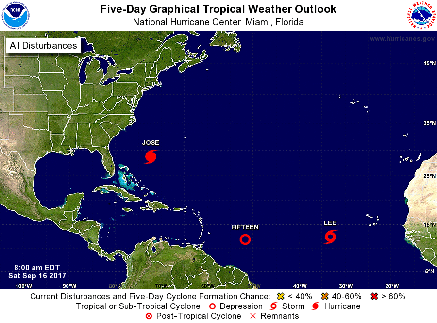
The National Hurricane Center is issuing advisories on Hurricane
Jose, located several hundred miles south-southeast of Cape
Hatteras, North Carolina, and on Tropical Depression Fourteen,
located over the eastern Atlantic Ocean.
1. Showers and thunderstorms associated with a tropical wave located
about 700 miles east of the Windward Islands continue to show signs
of organization, but it is unclear if the system has a well-defined
center of circulation. Environmental conditions are conducive for
additional development, and a tropical depression or tropical storm
could form at any time today or on Sunday while the system moves
west-northwestward at about 15 mph. Hurricane or tropical storm
watches could be issued for portions of the Lesser Antilles later
today, and interests on those islands should closely monitor the
progress of this system.
* Formation chance through 48 hours...high...90 percent.
* Formation chance through 5 days...high...90 percent.
Forecaster Berg