ZCZC MIATWOAT ALL
TTAA00 KNHC DDHHMM
Tropical Weather Outlook
NWS National Hurricane Center Miami FL
200 AM EDT Fri Sep 15 2017
For the North Atlantic...Caribbean Sea and the Gulf of Mexico:
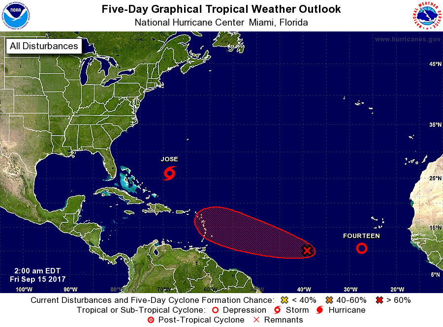
The National Hurricane Center is issuing advisories on Tropical
Storm Jose, located over the southwestern Atlantic Ocean, and on
newly developed Tropical Depression Fourteen, located over the
eastern Atlantic Ocean.
1. A tropical wave located about 1200 miles east-southeast of the
Lesser Antilles continues to produce disorganized showers and
thunderstorms. Environmental conditions are expected to be
conducive for gradual development, and a tropical depression is
likely to form early next week. Interests in the Lesser Antilles
should closely monitor the progress of this system while it moves
westward to west-northwestward at about 15 mph.
* Formation chance through 48 hours...medium...40 percent.
* Formation chance through 5 days...high...80 percent.
Public Advisories on Tropical Depression Fourteen are issued under
WMO header WTNT34 KNHC and under AWIPS header MIATCPAT4.
Forecast/Advisories on Tropical Depression Fourteen are issued under
WMO header WTNT24 KNHC and under AWIPS header MIATCMAT4.
Forecaster Zelinsky