ZCZC MIATWOEP ALL
TTAA00 KNHC DDHHMM
Tropical Weather Outlook
NWS National Hurricane Center Miami FL
1100 AM PDT Sun Sep 10 2017
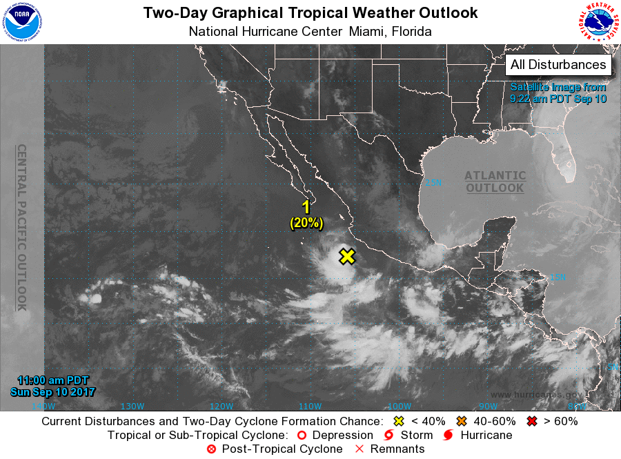
For the eastern North Pacific...east of 140 degrees west longitude:
1. An area of showers and thunderstorms associated with the remnants of
Katia, located a couple hundred miles south of southwestern Mexico,
is showing some signs or organization. Environmental conditions are
not favorable for significant development as the system moves
westward at about 10 mph.
* Formation chance through 48 hours...low...20 percent.
* Formation chance through 5 days...low...20 percent.
2. An area of low pressure is expected to form a few hundred miles
south of southern Mexico in the next day or two. Environmental
conditions are expected to be conducive for gradual development
while the system moves slowly northward or northwestward.
* Formation chance through 48 hours...low...10 percent.
* Formation chance through 5 days...medium...50 percent.
3. Another area of low pressure is expected to form well south of
the Baja California peninsula by the middle of this week.
Environmental conditions are expected to be conducive for gradual
development after that time while it moves northward or
northwestward.
* Formation chance through 48 hours...low...near 0 percent.
* Formation chance through 5 days...medium...50 percent.
Forecaster Avila