ZCZC MIATWOEP ALL
TTAA00 KNHC DDHHMM
Tropical Weather Outlook
NWS National Hurricane Center Miami FL
1100 AM PDT Thu Jul 27 2017
For the eastern North Pacific...east of 140 degrees west longitude:
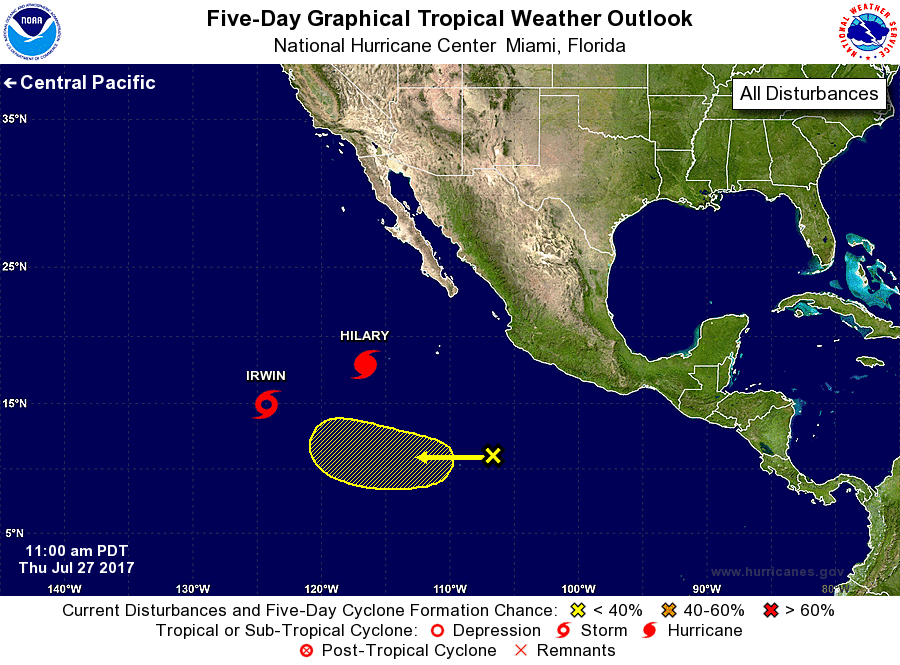
The National Hurricane Center is issuing advisories on Hurricane
Hilary, located several hundred miles southwest of the southern tip
of the Baja California peninsula, and on Tropical Storm Irwin,
located about 1000 miles west-southwest of the southern tip
of the Baja California peninsula.
1. A tropical wave, located several hundred miles south of Manzanillo,
Mexico, is producing limited shower and thunderstorm activity.
Environmental conditions are expected to be generally unfavorable
for development for the next several days, due in part to the close
proximity of Hurricane Hilary. The wave is expected to continue
moving slowly westward at 5 to 10 mph.
* Formation chance through 48 hours...low...near 0 percent.
* Formation chance through 5 days...low...10 percent.
Forecaster Zelinsky