ZCZC MIATWOEP ALL
TTAA00 KNHC DDHHMM
Tropical Weather Outlook
NWS National Hurricane Center Miami FL
500 PM PDT Wed Jul 5 2017
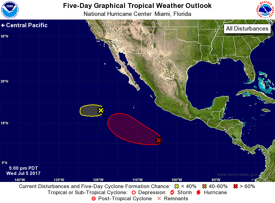
For the eastern North Pacific...east of 140 degrees west longitude:
1. Showers and thunderstorms associated with a low pressure area
located about 675 miles west-southwest of the southern tip of the
Baja California peninsula have continued to decrease this
afternoon. The low is moving westward at 10 to 15 mph into less
favorable environment conditions, and the chances of this system
becoming a tropical depressions are decreasing.
* Formation chance through 48 hours...low...30 percent.
* Formation chance through 5 days...low...30 percent.
2. Showers and thunderstorms have increased today in association with
a broad area of low pressure located several hundred miles south
of Manzanillo, Mexico. Environmental conditions are expected to be
favorable for additional development, and this system is likely to
become a tropical depression this weekend while the disturbance
moves generally westward to west-northwestward at about 10 mph away
from the coast of Mexico.
* Formation chance through 48 hours...low...20 percent.
* Formation chance through 5 days...high...80 percent.
Forecaster Brown