ZCZC MIATWOAT ALL
TTAA00 KNHC DDHHMM
Tropical Weather Outlook
NWS National Hurricane Center Miami FL
200 AM EDT Tue Jul 4 2017
For the North Atlantic...Caribbean Sea and the Gulf of Mexico:
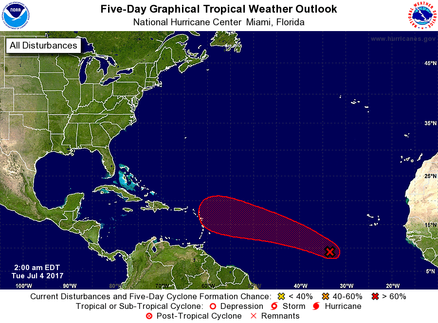
1. Recent satellite-derived wind data indicate that the well-defined
low pressure system located about 750 miles west-southwest of the
Cabo Verde Islands is producing winds to near tropical storm force
close to the center. Showers and thunderstorms have increased and
become a little better organized over the past several hours and, if
this recent development trend continues, a tropical depression or a
tropical storm could form later today or on Wednesday. The low is
expected to move slowly westward today, and then move toward the
west-northwest at 10 to 15 mph by tonight and on Wednesday.
* Formation chance through 48 hours...high...70 percent.
* Formation chance through 5 days...high...80 percent.
Forecaster Stewart