Skip Navigation Links
NOAA NOAA United States Department of Commerce

NHC Graphical Outlook Archive


« Earliest Available         ‹ Earlier         Later ›         Latest Available »
GIS Shapefiles
tab Eastern North Pacific tab tab Atlantic tab

View 2-Day Graphical Tropical Weather Outlook
Click for Eastern North Pacific Click for Eastern North Pacific

Tropical Weather Outlook Text

ZCZC MIATWOAT ALL
TTAA00 KNHC DDHHMM

Tropical Weather Outlook
NWS National Hurricane Center Miami FL
200 PM EDT Mon Jul 3 2017

For the North Atlantic...Caribbean Sea and the Gulf of Mexico:

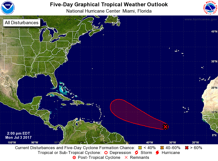
1. Showers and thunderstorms have become a little better organized in
association with a nearly stationary area of low pressure located
about 700 miles west-southwest of the Cabo Verde Islands. Gradual
development of this system is likely, and a tropical depression
could form later this week.  The disturbance is expected to begin
moving west-northwestward in a day or so, and it should continue
moving in that direction through the remainder of the week.
* Formation chance through 48 hours...low...30 percent.
* Formation chance through 5 days...high...70 percent.

Forecaster Cangialosi


List of Atlantic Outlooks (May 2023 - present)
List of East Pacific Outlooks (May 2023 - present)
List of Central Pacific Outlooks (May 2023 - present)
List of Atlantic Outlooks (July 2014 - April 2023)
List of East Pacific Outlooks (July 2014 - April 2023)
List of Central Pacific Outlooks (June 2019 - April 2023)
List of Atlantic Outlooks (June 2009 - June 2014)
List of East Pacific Outlooks (June 2009 - June 2014)