ZCZC MIATWOEP ALL
TTAA00 KNHC DDHHMM
Tropical Weather Outlook
NWS National Hurricane Center Miami FL
500 AM PDT Sat Jun 24 2017
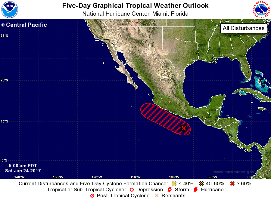
For the eastern North Pacific...east of 140 degrees west longitude:
1. Thunderstorm activity associated with a low pressure system located
a few hundred miles southeast of Acapulco, Mexico, has continued to
become better organized since yesterday. Upper-level winds are
gradually becoming more conducive for development, and a tropical
depression is likely to form later today or on Sunday while the low
moves west-northwestward at 10 mph parallel to the coast of Mexico.
Heavy rains are possible in the Mexican states of Oaxaca and
Guerrero during the next couple of days, and interests along the
southwestern coast of Mexico should monitor the progress of this
system.
* Formation chance through 48 hours...high...90 percent.
* Formation chance through 5 days...high...90 percent.
Forecaster Stewart