ZCZC MIATWOAT ALL
TTAA00 KNHC DDHHMM
Special Tropical Weather Outlook
NWS National Hurricane Center Miami FL
1250 PM EDT Mon Apr 17 2017
For the North Atlantic...Caribbean Sea and the Gulf of Mexico:
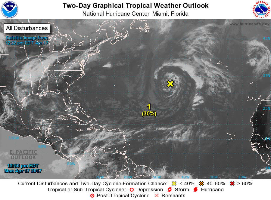
1. A non-tropical low pressure system located over the central Atlantic
about midway between Bermuda and the Azores Islands is producing an
area of gale-force winds to the west of the center. This low is
currently producing only limited shower activity, but environmental
conditions could favor additional development and this system has
some potential to become a subtropical cyclone over the next day or
so as it moves generally eastward. The next Special Tropical
Weather Outlook will be issued by 2 PM EDT Tuesday. For additional
information on this system, please see High Seas Forecasts issued by
the National Weather Service.
* Formation chance through 48 hours...low...30 percent
* Formation chance through 5 days...low...30 percent
High Seas Forecasts issued by the National Weather Service can be
found under AWIPS header NFDHSFAT1, WMO header FZNT01 KWBC, and on
the Web at http://www.opc.ncep.noaa.gov/shtml/NFDHSFAT1.shtml.
Forecaster Franklin/Stewart