ZCZC MIATWOAT ALL
TTAA00 KNHC DDHHMM
TROPICAL WEATHER OUTLOOK
NWS NATIONAL HURRICANE CENTER MIAMI FL
100 PM EST SUN NOV 20 2016
For the North Atlantic...Caribbean Sea and the Gulf of Mexico:
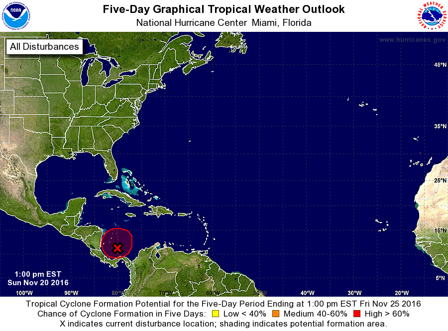
1. A broad area of low pressure continues over the extreme southwestern
Caribbean Sea. Although the system's circulation appears to have
become a little better defined, the associated thunderstorm activity
is rather limited at this time. Environmental conditions are
marginally conducive for development, and a tropical depression
could form during the next couple of days while the low moves slowly
and erratically. An Air Force reconnaissance aircraft is
scheduled to investigate the area later this afternoon. For
additional information on this system, see High Seas Forecasts
issued by the National Weather Service.
* Formation chance through 48 hours...medium...50 percent
* Formation chance through 5 days...high...70 percent
High Seas Forecasts issued by the National Weather Service can be
found under AWIPS header NFDHSFAT1, WMO header FZNT01 KWBC, and
at http://www.opc.ncep.noaa.gov/shtml/NFDHSFAT1.shtml.
Forecaster Pasch