ZCZC MIATWOAT ALL
TTAA00 KNHC DDHHMM
TROPICAL WEATHER OUTLOOK
NWS NATIONAL HURRICANE CENTER MIAMI FL
700 PM EST SAT NOV 19 2016
For the North Atlantic...Caribbean Sea and the Gulf of Mexico:
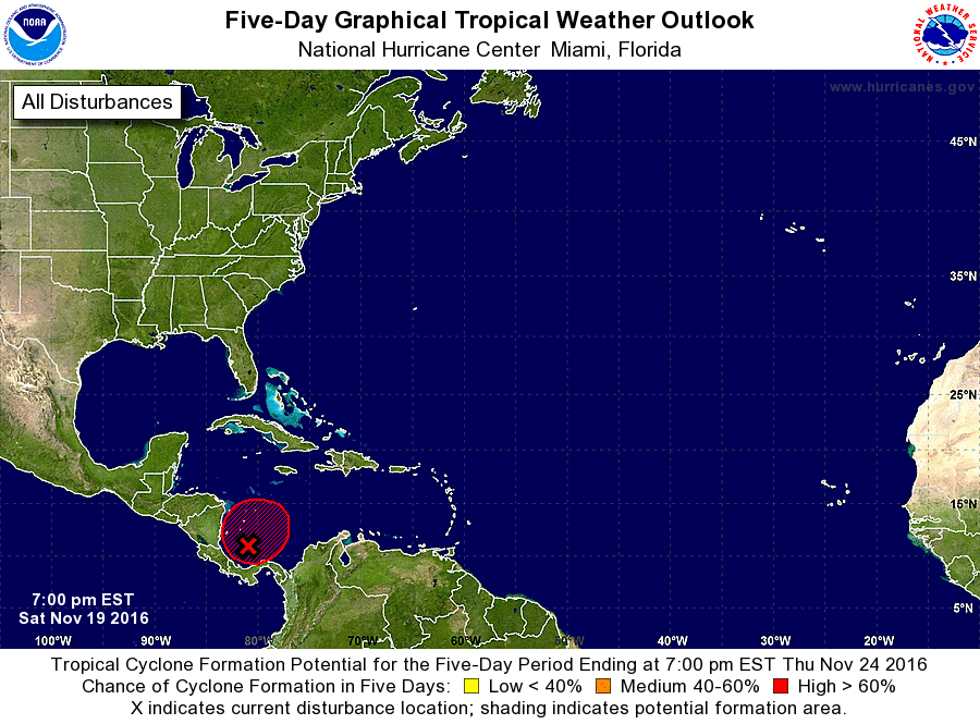
1. Shower and thunderstorm activity has diminished during the past few
hours in association with an area of low pressure located over the
southwestern Caribbean Sea. Environmental conditions are marginally
conducive for further development, and a tropical depression could
form during the next few days while the low moves slowly and
erratically. For additional information on this system, see High
Seas Forecasts issued by the National Weather Service.
* Formation chance through 48 hours...medium...50 percent
* Formation chance through 5 days...high...70 percent
High Seas Forecasts issued by the National Weather Service can be
found under AWIPS header NFDHSFAT1, WMO header FZNT01 KWBC, and
at http://www.opc.ncep.noaa.gov/shtml/NFDHSFAT1.shtml.
Forecaster Brennan