ZCZC MIATWOEP ALL
TTAA00 KNHC DDHHMM
SPECIAL TROPICAL WEATHER OUTLOOK
NWS NATIONAL HURRICANE CENTER MIAMI FL
135 PM PST SUN NOV 13 2016
For the eastern North Pacific...east of 140 degrees west longitude:
Special tropical weather outlook issued to update the discussion of
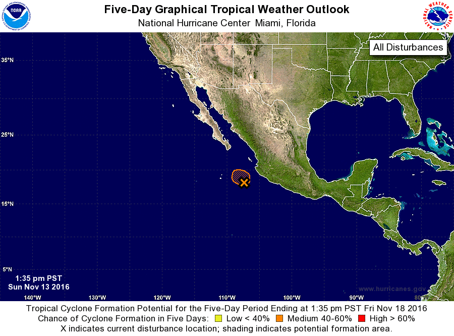
the low pressure system southwest of Manzanillo, Mexico.
1. Satellite wind data indicate that the circulation of the low
pressure system located about 180 miles west-southwest of
Manzanillo, Mexico, has become much better defined and is producing
winds to tropical storm force well east of the center. Strong
upper-level winds are likely to increase further and preclude
significant development. However, any additional increase in
organization could result in the formation of a tropical cyclone.
Regardless of tropical cyclone formation, this disturbance is
expected to produce total rainfall amounts of 3 to 6 inches over
portions of Colima and western Jalisco in Mexico through Monday.
* Formation chance through 48 hours...medium...50 percent
* Formation chance through 5 days...medium...50 percent
Forecaster Kimberlain/Beven