ZCZC MIATWOEP ALL
TTAA00 KNHC DDHHMM
TROPICAL WEATHER OUTLOOK
NWS NATIONAL HURRICANE CENTER MIAMI FL
1100 PM PDT FRI OCT 21 2016
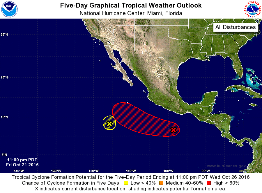
For the eastern North Pacific...east of 140 degrees west longitude:
1. An area of showers and thunderstorms located a few hundred miles
southwest of the Gulf of Tehuantepec is associated with a broad area
of low pressure. Environmental conditions are expected to be
conducive for development of this disturbance during the next few
days, and a tropical depression will likely form by early next week
while the system moves west-northwestward at 10 to 15 mph.
* Formation chance through 48 hours...medium...50 percent
* Formation chance through 5 days...high...80 percent
2. A small area of low pressure located about 800 miles south-southwest
of the southern tip of the Baja California peninsula continues to
produce disorganized cloudiness and showers. Further development
of this system is unlikely due to strong upper-level winds while
the low drifts northward or northwestward over the next few days.
* Formation chance through 48 hours...low...10 percent
* Formation chance through 5 days...low...10 percent
Forecaster Brennan