ZCZC MIATWOEP ALL
TTAA00 KNHC DDHHMM
TROPICAL WEATHER OUTLOOK
NWS NATIONAL HURRICANE CENTER MIAMI FL
500 AM PDT MON OCT 10 2016
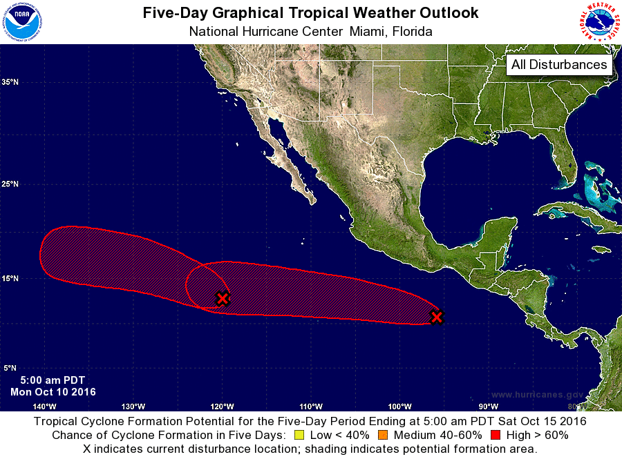
For the eastern North Pacific...east of 140 degrees west longitude:
1. A complex area of low pressure located several hundred miles
southwest of the southern tip of the Baja California peninsula
continues to produce widespread cloudiness and showers. This area of
disturbed weather is expected to slowly consolidate during the next
few days, and a tropical depression is likely to form later this
week while the system moves west-northwestward to northwestward.
* Formation chance through 48 hours...low...30 percent
* Formation chance through 5 days...high...70 percent
2. Disorganized cloudiness and shower activity located a few hundred
miles south of the Gulf of Tehuantepec are associated with a weak
low pressure system. Environmental conditions are expected to
generally be conducive for development of this system, and a
tropical depression is likely to form later this week while the low
moves west-northwestward.
* Formation chance through 48 hours...low...20 percent
* Formation chance through 5 days...high...80 percent
Forecaster Kimberlain