ZCZC MIATWOEP ALL
TTAA00 KNHC DDHHMM
TROPICAL WEATHER OUTLOOK
NWS NATIONAL HURRICANE CENTER MIAMI FL
1100 AM PDT SAT OCT 8 2016
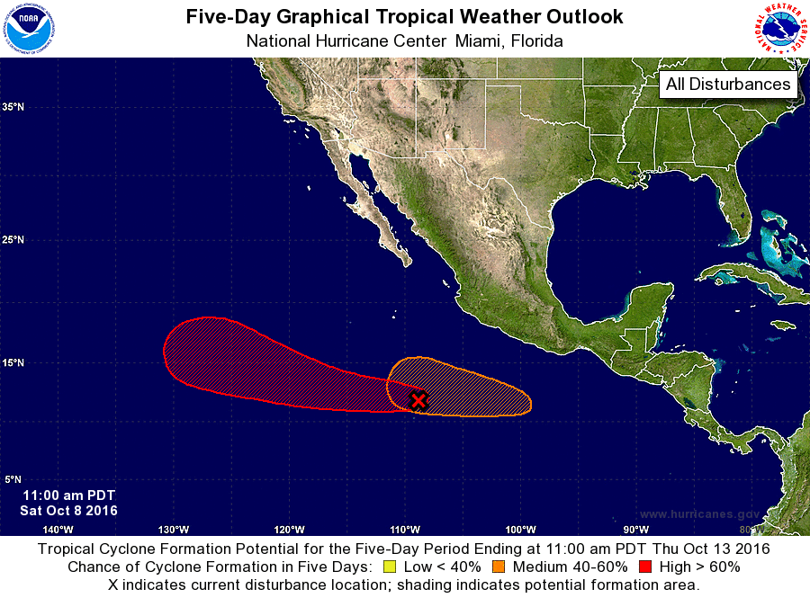
For the eastern North Pacific...east of 140 degrees west longitude:
1. A large area of disorganized showers and thunderstorms, extending
from several hundred miles south through southwest of the southern
tip of the Baja California peninsula, is associated with a trough of
low pressure. Environmental conditions are expected to be conducive
for gradual development of this disturbed weather, and a tropical
depression is likely to form by the early or middle part of next
week while this system moves west-northwestward.
* Formation chance through 48 hours...low...20 percent
* Formation chance through 5 days...high...70 percent
2. An area of low pressure is expected to develop several hundred miles
south or southwest of the southwestern coast of Mexico by early
next week. Environmental conditions are expected to be conducive for
additional development, and a tropical depression could form while
this system moves westward and then west-northwestward.
* Formation chance through 48 hours...low...near 0 percent
* Formation chance through 5 days...medium...60 percent
Forecaster Kimberlain