ZCZC MIATWOEP ALL
TTAA00 KNHC DDHHMM
TROPICAL WEATHER OUTLOOK
NWS NATIONAL HURRICANE CENTER MIAMI FL
1100 PM PDT SUN SEP 25 2016
For the eastern North Pacific...east of 140 degrees west longitude:
The National Hurricane Center is issuing advisories on Tropical
Depression Eighteen-E, located well southwest of the southern tip of
the Baja California peninsula.
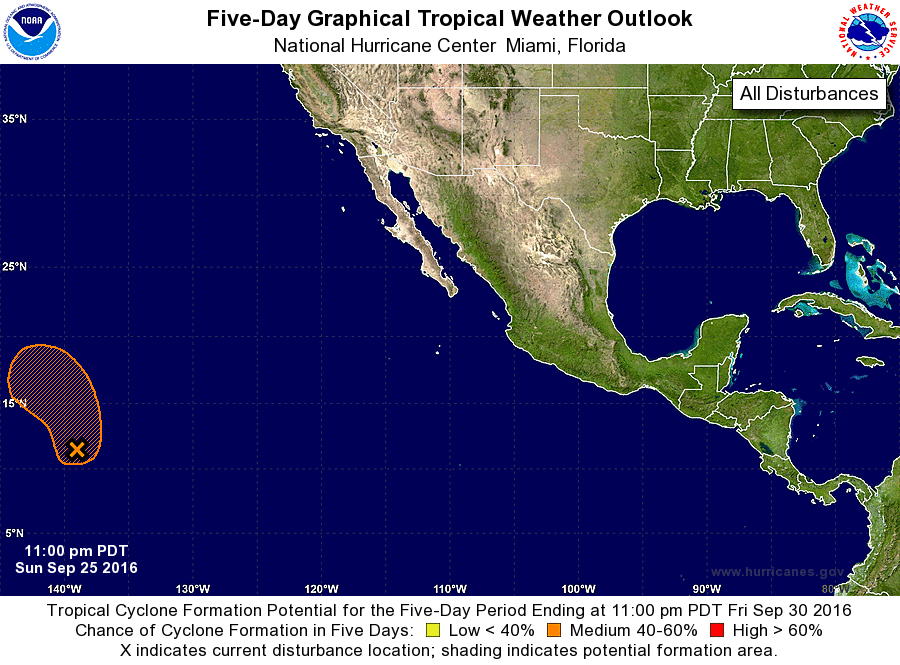
1. An area of low pressure is located near the Central Pacific basin
about 1200 miles east-southeast of the Big Island of Hawaii. Shower
and thunderstorm activity has increased and become better organized
since yesterday, and environmental conditions are expected to be
conducive for the development of a tropical depression later this
week. This low is forecast to move little during the next day or two
and then turn northward.
* Formation chance through 48 hours...medium...40 percent
* Formation chance through 5 days...medium...60 percent
Public Advisories on Tropical Depression Eighteen-E are issued under
WMO header WTPZ33 KNHC and under AWIPS header MIATCPEP3.
Forecast/Advisories on Tropical Depression Eighteen-E are issued
under WMO header WTPZ23 KNHC and under AWIPS header MIATCMEP3.
Forecaster Stewart