ZCZC MIATWOAT ALL
TTAA00 KNHC DDHHMM
TROPICAL WEATHER OUTLOOK
NWS NATIONAL HURRICANE CENTER MIAMI FL
800 PM EDT SUN SEP 25 2016
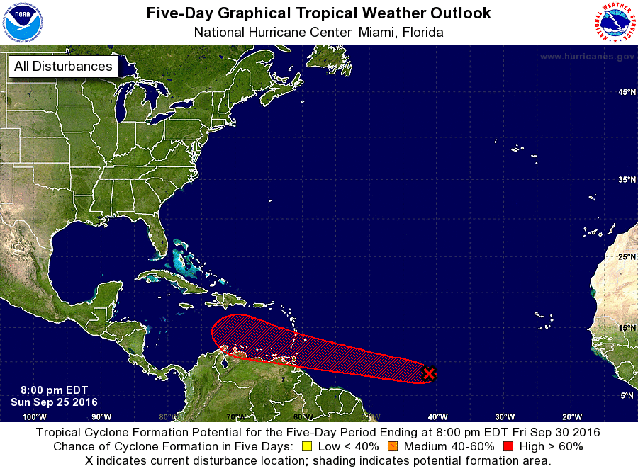
For the North Atlantic...Caribbean Sea and the Gulf of Mexico:
1. Shower and thunderstorm activity associated with a low pressure
area located about 1300 miles east-southeast of the Windward Islands
has changed little in organization since earlier today.
Environmental conditions are expected to be conducive for gradual
development, and a tropical depression is likely to form later this
week while the low moves westward to west-northwestward at 15 to 20
mph. Interests in the Windward Islands, the southeastern and
south-central Caribbean Sea, as well as the northern coast of South
America, should monitor the progress of this system.
* Formation chance through 48 hours...low...30 percent
* Formation chance through 5 days...high...90 percent
Forecaster Pasch