ZCZC MIATWOEP ALL
TTAA00 KNHC DDHHMM
TROPICAL WEATHER OUTLOOK
NWS NATIONAL HURRICANE CENTER MIAMI FL
1100 AM PDT FRI SEP 23 2016
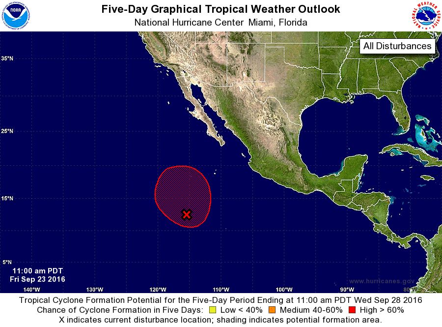
For the eastern North Pacific...east of 140 degrees west longitude:
1. A broad area of low pressure is located about 800 miles south-
southwest of the southern tip of the Baja California peninsula.
While shower and thunderstorm activity has increased during the past
several hours, there are still no signs of a well-defined surface
circulation. Environmental conditions are expected to support the
development of a tropical depression over the weekend while the
disturbance moves slowly toward the northwest and then north at
about 5 to 10 mph.
* Formation chance through 48 hours...high...70 percent
* Formation chance through 5 days...high...90 percent
Forecaster Roberts