ZCZC MIATWOEP ALL
TTAA00 KNHC DDHHMM
TROPICAL WEATHER OUTLOOK
NWS NATIONAL HURRICANE CENTER MIAMI FL
500 PM PDT MON SEP 19 2016
For the eastern North Pacific...east of 140 degrees west longitude:
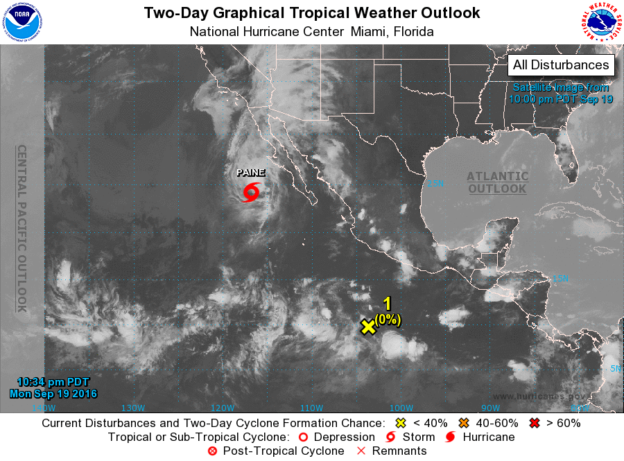
The National Hurricane Center is issuing advisories on Hurricane
Paine, located a few hundred miles west of the Baja California
peninsula.
1. A tropical wave located about 500 miles south-southwest of Acapulco,
Mexico, is producing disorganized showers and thunderstorms. An
area of low pressure is expected to develop in association with the
wave well south of the Baja California peninsula in a day or two.
Any development of low should be slow to occur while it moves
northwestward or northward later this week.
* Formation chance through 48 hours...low...near 0 percent
* Formation chance through 5 days...low...30 percent
Forecaster Brown