ZCZC MIATWOAT ALL
TTAA00 KNHC DDHHMM
TROPICAL WEATHER OUTLOOK
NWS NATIONAL HURRICANE CENTER MIAMI FL
800 PM EDT SUN SEP 18 2016
For the North Atlantic...Caribbean Sea and the Gulf of Mexico:
The National Hurricane Center is issuing advisories on Tropical
Depression Julia, located just offshore of the coast of South
Carolina, and on Tropical Storm Karl, located well east of the
Leeward Islands.
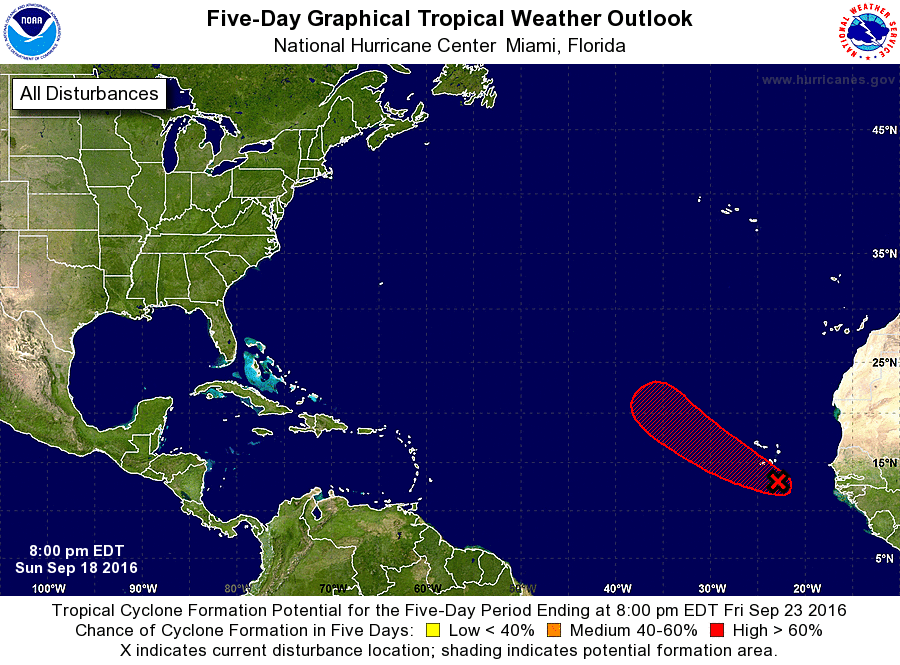
1. A broad area of low pressure located near the Cabo Verde Islands is
producing disorganized cloudiness and thunderstorms. Gradual
development of this system is likely, and a tropical depression
could form within the next few days before environmental conditions
become less conducive late this week. This system is expected to
move west-northwestward to northwestward over the eastern Atlantic
during the next several days. Regardless of development, locally
heavy rains and strong gusty winds are possible in the Cabo Verde
Islands during the next day or so.
* Formation chance through 48 hours...medium...50 percent
* Formation chance through 5 days...high...80 percent
Forecaster Cangialosi